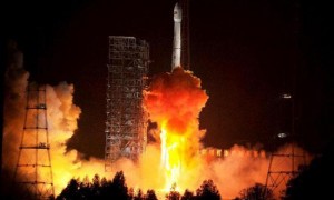
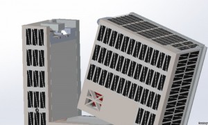
The Bozeman entry was picked out of more than 900 schools representing 11000 students.
最终,博兹曼校区从900座学校中脱颖而出,代表11000名学生给这两颗卫星命名。孩
互联网摘选
利用包括卫星估算在内的几种简单的方法来研究云对辐射的作用和辐射收支问题。
互联网摘选
包围大气层的外部空间人造卫星来去匆匆,形成一个在大气层外面的所谓技术层。
互联网摘选
美国国家科学院的报告强调了立方体卫星在科学探索和培养未来太空科学家和工程师方面的重要性。
六级真题- 2019年 6月 3卷 信息匹配
Accurate Adjustment of Pointing and Polarization Angle of Satellite Receiving Antenna
卫星接收天线的指向及极化倾角的准确调整
互联网摘选
在这个应用领域中,GNSS卫星主要用来探测对流层中的水汽含量和电离层中的电子密度等,是天气预报和气候监测的一个重要工具。
互联网摘选
Linear localization algorithm of aeromodelling based on satellites positioning technology
基于卫星定位技术的航模线性化定位方法
互联网摘选
Promotor Identification of Satellite DNA β Associated with Ageratum Yellow Vein Virus Isolate F1
胜红蓟黄脉病毒F1分离物伴随卫星小分子DNAβ的启动子鉴定
互联网摘选
Monitoring Level Fluctuation of Lakes in Yangtze River Basin by Altimetry
利用卫星测高资料监测长江中下游湖泊水位变化
互联网摘选
Several Problems in the Application of Satellite Altimetry in Physical Geodesy
卫星测高在物理大地测量应用中的若干问题
互联网摘选
Effects of vertical deflection correction on sea surface height model from Altimetry Data
垂线偏差对用卫星测高数据建立海面高模型的影响
互联网摘选
Influence of Tide Model on Mean Sea Level Variation Using Altimetry Data
潮汐模型对利用卫星测高数据研究海平面变化的影响
互联网摘选
第二,每个数据的类别标签参考国家卫星气象中心的云分类产品结果,将实验数据划分为地表、混合像元、高层云或雨层云、卷层云、密卷云、积雨云以及层积云或高积云7类。
互联网摘选
Circuitry design and analysis must involve antenna gain in satellite communications.
卫星通信线路的设计或分析一定涉及到天线增益。
互联网摘选
On Characteristics of Deployable Antenna Mast and Satellite Coupled Vibration
可展天线臂与卫星间耦合振动特性研究
互联网摘选
Counications satellites are used for international live transmission throughout the world.
全世界都将通信卫星用于国际的实况转播.
互联网摘选
They will claim any unexpected light to be such a comet, or its tail.
但又害怕完全使卫星停工会欲盖弥彰, 进一步引起公众对此问题的兴趣.
互联网摘选